


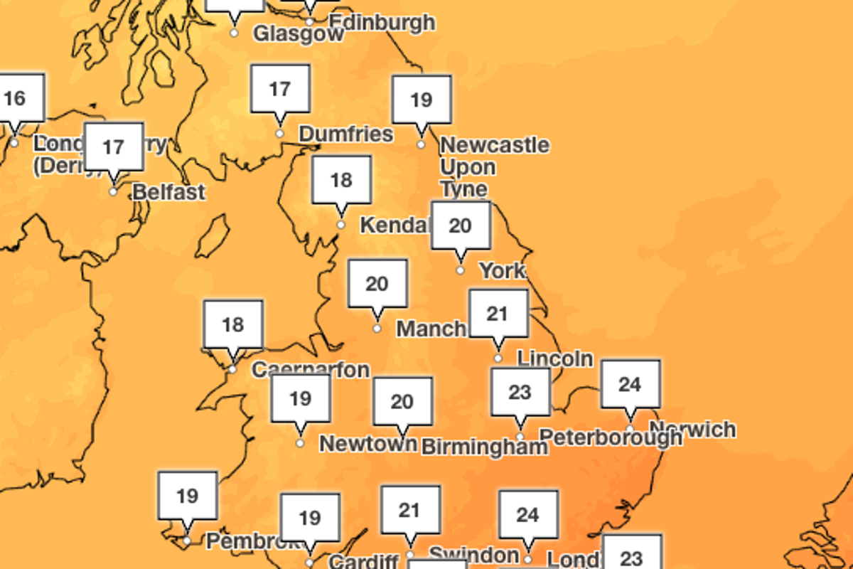
The UK is expected to return to milder temperatures this week after a weekend of summer-like conditions which saw parts of the country reach the mid-20s on the mercury.
A southerly wind drawing in hot and humid air from the continent saw temperatures pushed up above average on Sunday, as many were treated to sunshine and bright spells.
Conditions are still expected to be warm on Monday, with parts of the south east reaching 24C. But temperatures will fall to closer to the seasonal average on Tuesday as conditions become more changeable throughout the week.
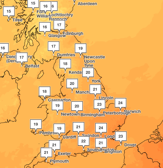
The mercury is expected to fall to highs of around 20C in London and parts of the south, and a much cooler 16C in Manchester and across the north of England, from Tuesday onwards.
It comes after the Met Office this week confirmed the UK has provisionally experienced its hottest summer since records began nearly 150 years ago.
Five heatwaves between May and August left the majority of the country in drought and have sparked wildfires and travel disruption.
The UK recorded a mean average temperature across June, July and August of 16.5C, beating the previous seasonal high of 16.1C set last year, the Met Office said.
The forecaster previously suggested the UK was on course for its hottest summer on record, provided temperatures remained around average for the rest of August, and it is expected the final figures for the month will break the previous record.
The highest temperature recorded this summer was on 13 August at Kew Gardens, when the mercury hit 38.1C.
While this did not beat the all-time highest record, which was measured at 40.3C in Lincolnshire in July 2022, several other records were broken, including a temperature of 37C or higher being recorded on three separate days.
Prior to 2026, temperatures of over 37C had only been recorded nine times in the UK – three of which have occurred this year.
Met Office five day forecast
Changeable through the week ahead.
Today:
Southern and central areas will be largely dry and bright today. Turning more unsettled in the north with blustery rain and gales in places. Feeling warm in the south in the sunny spells, fresher in the north.
Tonight:
A band of rain moves south across England and Wales tonight, turning heavy at times. Blustery showers in the north with strong winds.
Tuesday:
Heavy rain slowly clearing the southeast in the morning. A brighter day for many and feeling fresh. Winds gradually easing in the north, with showers too.
Outlook for Wednesday to Friday:
Drier and brighter on Wednesday with spells of sunshine. Another band of rain then moves in for Thursday, before drier and brighter weather returns on Friday. Temperatures likely around average.