


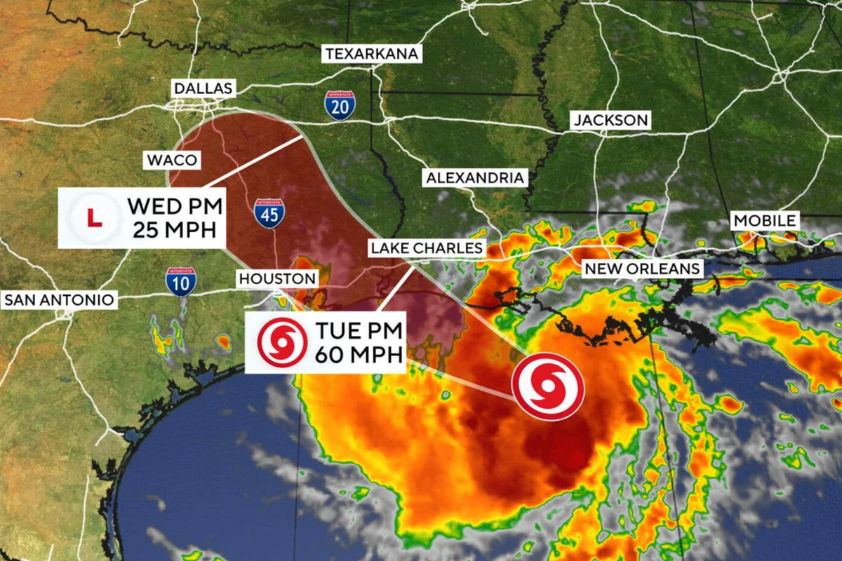
Texas and Louisiana are bracing for Tropical Storm Edouard, which is expected to make landfall Tuesday.
The storm, which has strengthened while heading towards the Texas Gulf Coast, threatens to bring with it heavy rain that could lead to flash flooding.
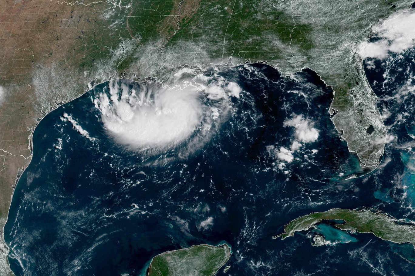
Early Tuesday the storm was about 65 miles south-southeast of Cameron, Louisiana, and 90 miles southeast of Port Arthur, Texas, with maximum sustained winds of 40 mph while moving west-northwest at 8 mph.
The National Hurricane Center warned the storm could approach hurricane strength before reaching the northwest Gulf Coast.
“The biggest problem we expect with the storm at this moment in time is flooding,” Texas Governor Greg Abbott said at a Monday press conference. “Some local rainfall may be as high as 10-15 inches. Some could be 3 or 4 inches per hour.”
 open image in gallery
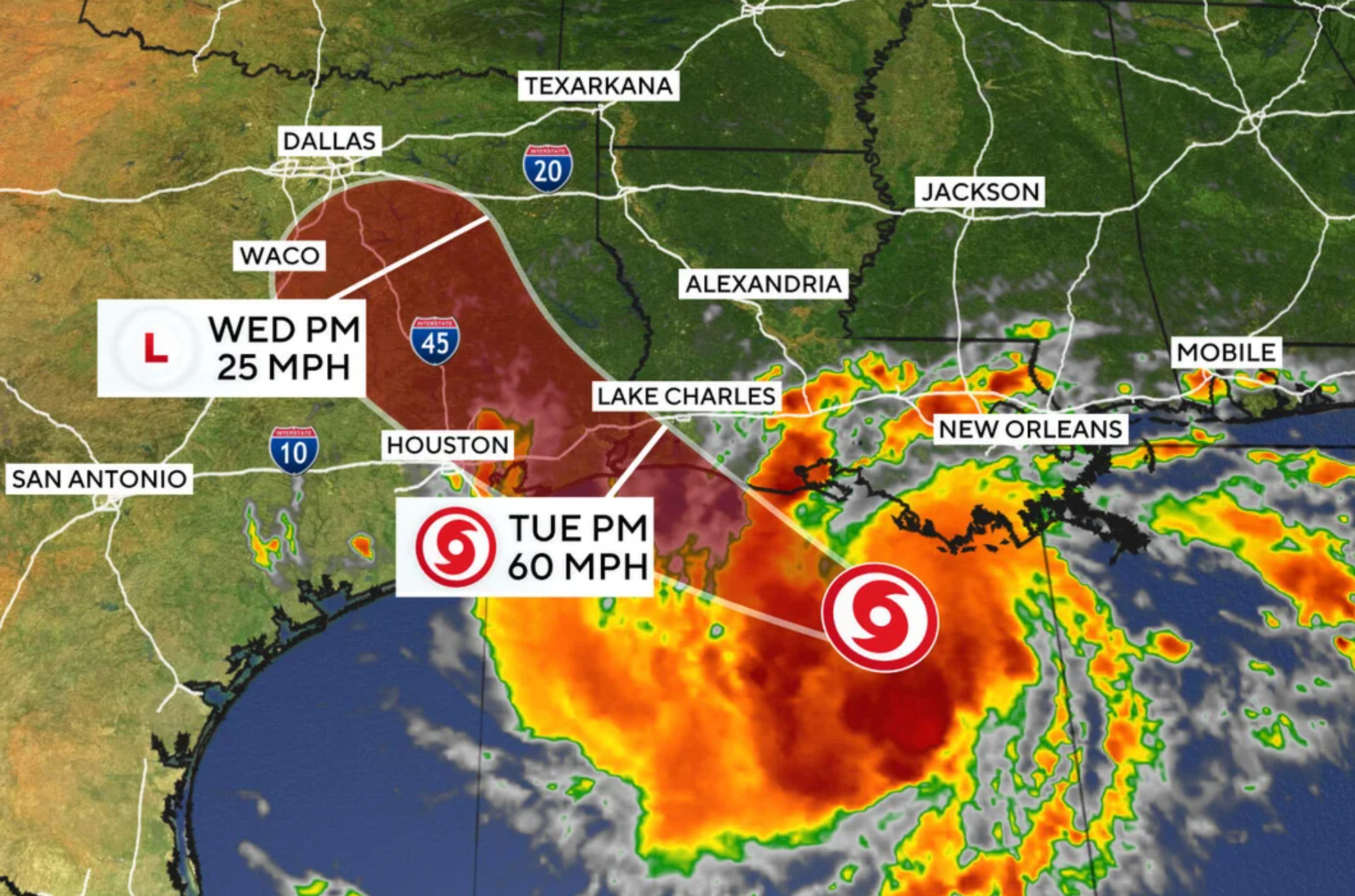
Rain will sweep into Houston by midday on Tuesday, with up to 2-8 inches of rainfall being expected in the Space City and the nearby upper Texas coast, AccuWeather reports. In some areas east of Houston, as much as 12 inches of rain could fall.
Meanwhile, in some Gulf Coast areas, winds could reach up to 60 mph.
In Monday’s press conference, Abbott said that Texas was prepared to deploy emergency resources, including rescue aircraft, high water vehicles and swift water rescue boats.
“It’s so incredibly important for anybody in any region of the state, but especially in Harris County, to avoid driving into what appears to be waters on the roadway,” he said. “Too often we see people get swept away or have their cars washed away, especially in the Harris County area because of rising waters.”
 open image in gallery
The NHC has warned of flash flooding from the Upper Texas coast into east-central Texas and Southwest Louisiana on Tuesday and Wednesday, particularly in urban centers.
The agency has stated that a storm surge warning is in effect for High Island up to the Vermilion/Cameron Parish Line.
Addressing reporters, Abbott also said that high winds bring with them the threat of fires.
“We are concerned about additional fires being caused by the storm coming in,” he said. “The storm is going to bring in very heavy wind and, once that wind hits the ground, it can quickly cause a spark to ignite.”
“An ignited spark spread (sic) literally like a wildfire,” he added.
 open image in gallery
Keith Stephens, a spokesperson for Houston’s CenterPoint Energy, warned that some wires may be brought down in the storm. However, Pablo Vegas, the CEO of the Electric Reliability Council of Texas, noted that there are no restrictions on energy usage amid the storm.
The NWS says that its tropical storm warning remains in effect until Wednesday morning for Chambers County and surrounding Gulf Coast areas.
Edouard is the fifth named storm of this Atlantic Hurricane Season. The Atlantic Hurricane Season typically runs from the start of June until the end of November.