
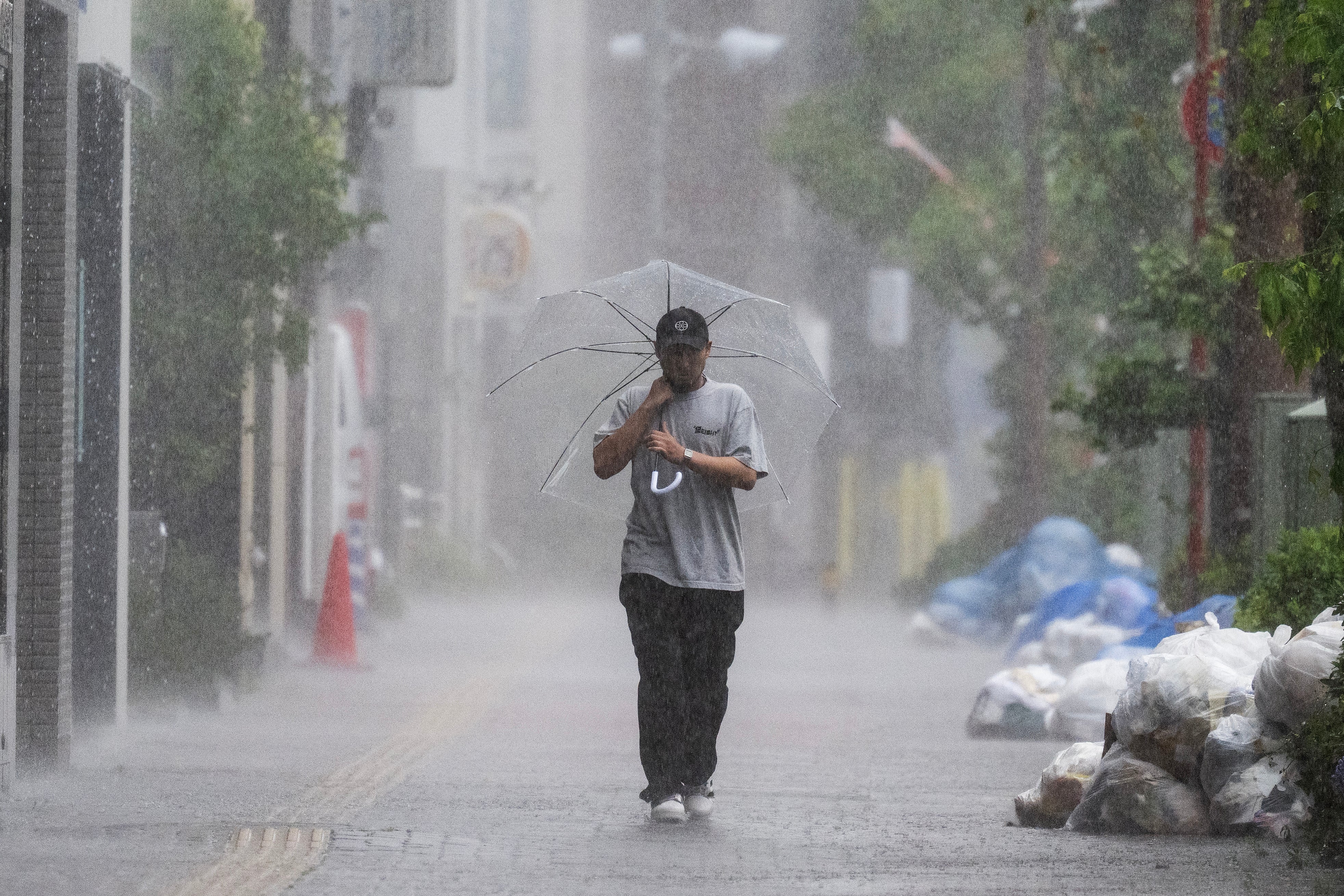
Typhoon Jangmi made landfall in Japan’s Wakayama prefecture early on Wednesday, bringing torrential rain and raising concerns about flooding and landslides.
Japanese weather officials issued their highest-level flood warnings in several areas, urging residents living near rivers or in low-lying locations to seek safety on higher ground.
In Tokyo, people living near the Zenpukuji river were advised to evacuate or take shelter as rising muddy waters approached overflow levels.
 open image in gallery
At the time of landfall, Jangmi was producing strong winds of up to 126kmph and moving east-northeast. Forecasters expect the storm to continue tracking eastward along the Pacific side of Japan, potentially affecting several regions over the coming days.
Japan’s Meteorological Agency warned that substantial rainfall is still expected, including parts of central and eastern Japan.
The storm caused widespread disruption across Japan, with heavy rain bringing traffic to a standstill in parts of Tokyo, forcing the cancellation of hundreds of flights and causing delays and suspensions on rail services.
More than 5,000 homes in the greater Tokyo region also lost power.
Authorities issued flood alerts in several areas of central and eastern Japan after some locations recorded exceptionally high rainfall, including around 50cm in the city of Owase over a 24-hour period.
 open image in gallery
Jangmi had earlier swept through Okinawa, where 16 people reportedly sustained minor injuries before the storm moved north and made landfall in Wakayama.
Landslide alerts were issued for several areas, including the Shizuoka prefecture cities of Ito, Shimoda and Atami, along with parts of Chiba and Kanagawa prefectures. Authorities also ordered evacuations in multiple locations, including Omaezaki in Shizuoka, Kihoku in Mie, Yokosuka in Kanagawa, Totsuka Ward in Yokohama, and the town of Otaki in Chiba. Meanwhile, another warning was issued for Iwaki city in Fukushima prefecture.
 open image in gallery
The Japan Meteorological Agency forecast up to 200mm of rain across the Kanto-Koshin and Tokai regions by Thursday morning, with as much as 120mm expected in Tohoku. It warned that rainfall totals could be significantly higher in areas where linear rainbands develop.
Several JR East routes were suspended from the start of the day on Wednesday, including sections of the Shonan-Shinjuku, Chuo, Ome and Tokaido lines, with operators expecting services on some routes to resume later in the afternoon or evening.
 open image in gallery
Train services on the Hachiko Line were also halted after branches became entangled in overhead power lines, according to local media reports.
A number of rail routes were expected to remain closed throughout the day, including sections of the Uchibo, Sobu Main, Kashima, Sotobo, Narita and Kururi lines. Tokyo Metro and other private railway companies warned passengers to expect additional delays and possible service suspensions as severe weather conditions persisted.
Long-distance and limited express services were also heavily affected. The Narita Express and the Azusa and Kaiji services were suspended from the first departures of the day, while all trains on routes including the Odoriko, Saphir Odoriko, Shiosai, Sazanami, Wakashio, Kinugawa, Spacia Nikko and Kusatsu/Shima services were cancelled.
Air travel was similarly impacted, with around 760 domestic flights and more than 90 international flights cancelled on Wednesday, according to NHK Japan.