
Weather modelling maps suggest 18 counties across the UK could see temperatures of 34C or more on Monday and Tuesday as the heatwave shows no sign of letting up.
The Met Office has said highs of 35C are possible across both days. They are likely to be the hottest days in May ever recorded. The current record stands at 32.8C.
Yesterday was the hottest day of the year so far as temperatures rose above 30C for the first time in 2026. Today is expected to be even warmer, with 32C highs possible in southern areas. The yearly record will likely be beaten on Monday and Tuesday too.
 View 3 Images
Maximum possible temperatures (C) at 3pm on Monday(Image: Weather Outlook)
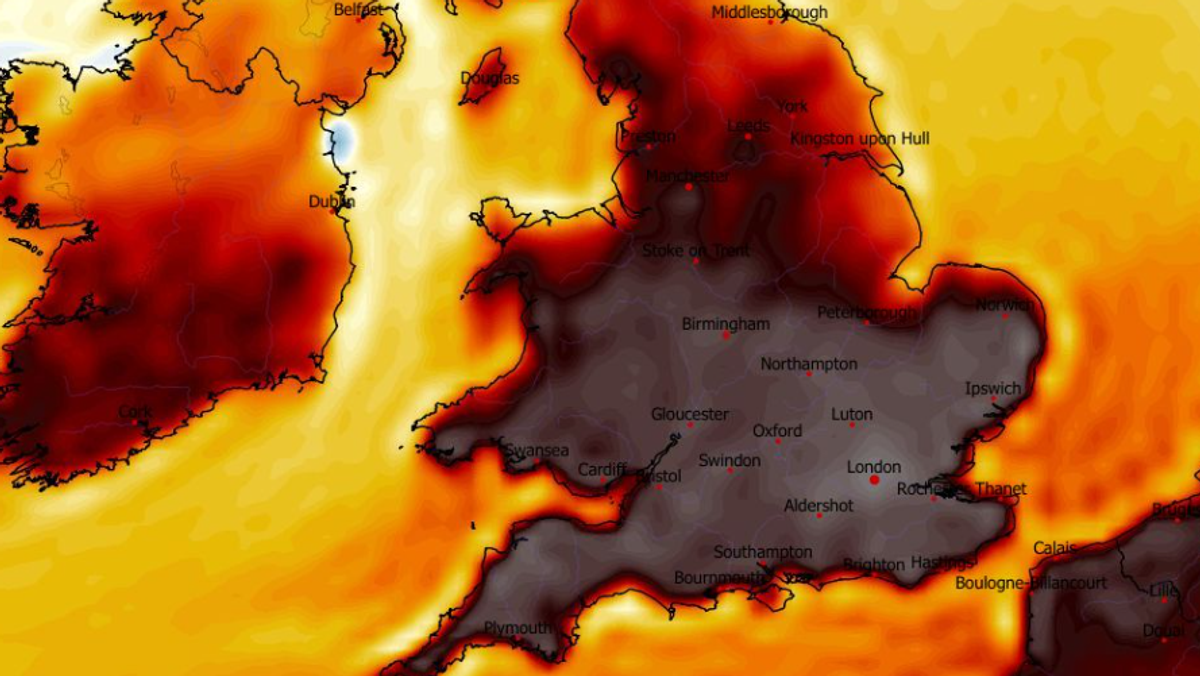
The UKV weather model suggests temperatures could surge to 34C on Monday as far north as Lincolnshire. Most of central and southern England will see temperatures in the low-30s.
Highs of 35C are possible in London and the south-west on Tuesday, the weather maps show. In total, the data suggests 18 counties – all in England – could see 34C or above.
 View 3 Images
Maximum possible temperatures (C) at 3pm on Tuesday(Image: Weather Outlook)
- Lincolnshire
- Nottinghamshire
- Norfolk
- Suffolk
- Essex
- Cambridgeshire
- Bedfordshire
- Surrey
- Berkshire
- Buckinghamshire
- Hertfordshire
- Hampshire
- Essex
- Kent
- Oxfordshire
- Somerset
- Dorset
- Wiltshire
The Met Office’s latest forecast suggests temperatures will keep peaking at 28C or more until at least Thursday. An official heatwave is declared when temperatures hit the heatwave threshold, which varies from 25C to 28C depending on the county, for three consecutive days.
Article continues below
There could be more “very warm” temperatures to come as we head into June too. The Met Office’s forecast for May 28 to June 6 states: “Fine weather and light winds are likely to continue for most places as high pressure expected to remain in place for much of the UK, although there may be a few showers with the odd rumble of thunder in the west on Thursday.
“Temperatures will remain be warm or very warm inland, but it will feel cooler near the coast, especially with an onshore breeze.
“Heading into June, more in the way of cloud is possible, perhaps accompanied by some rain and showers at times, though still a lot of warm and dry weather in between.”