

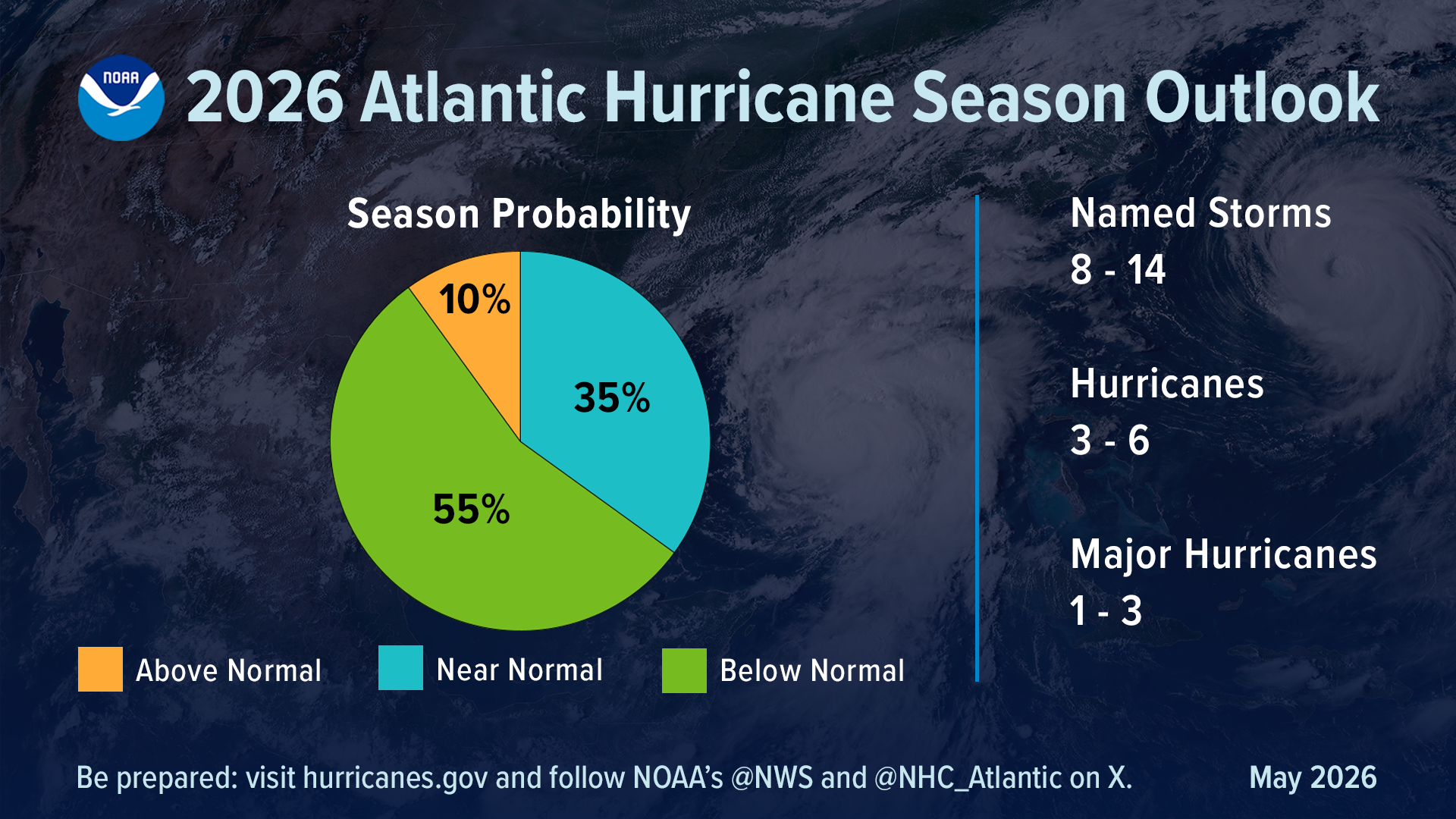
This year’s Atlantic hurricane season is forecast to be calmer than normal – but the eastern Pacific season won’t be as lucky, according to the National Oceanic and Atmospheric Administration.
That’s because of a seasonal climate pattern known as El Niño, which can suppress hurricane development over the Atlantic Ocean and increase those conditions over the Pacific.
An especially strong El Niño has contributed to a 70 percent chance of above-normal activity in the eastern Pacific, including storms that hit Hawaii and sometimes the West Coast.
The agency forecasts 9 to 14 hurricanes, including 5 to 9 major hurricanes. The season started on May 15 and typically runs through November 30, the end of the June 1 Atlantic hurricane season.
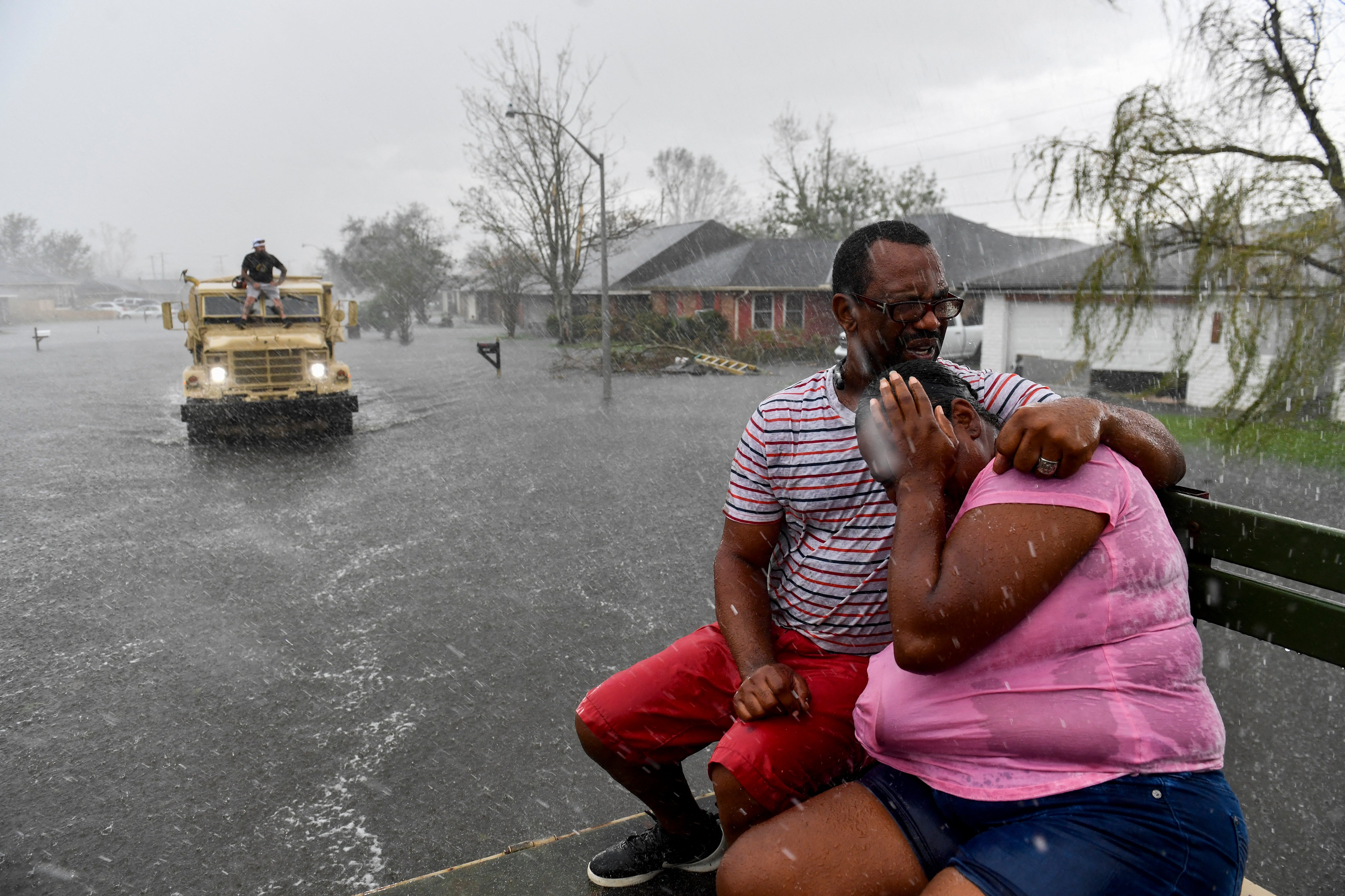
However, while the Atlantic region could only see 1 to 3 major hurricanes and 3 to 6 hurricanes, officials stressed that catastrophic Category 5 storms could still hit the eastern U.S. – and hit fast.
 open image in gallery
“It’s very important to understand that it only takes one,” Dr. Neil Jacobs, NOAA’s administrator, told reporters in a related news conference. “We have had Category 5s make landfall in the past during below average seasons.”
Category 5 hurricanes are the strongest on the federally used Saffir-Simpson Hurricane Wind Scale, which estimates potential property damage from winds only.
Maximum sustained winds for Category 5 hurricanes are measured at 157 miles per hour or higher. Although some scientists say Category 6 storms could be the new normal due to human-caused climate change.
 open image in gallery
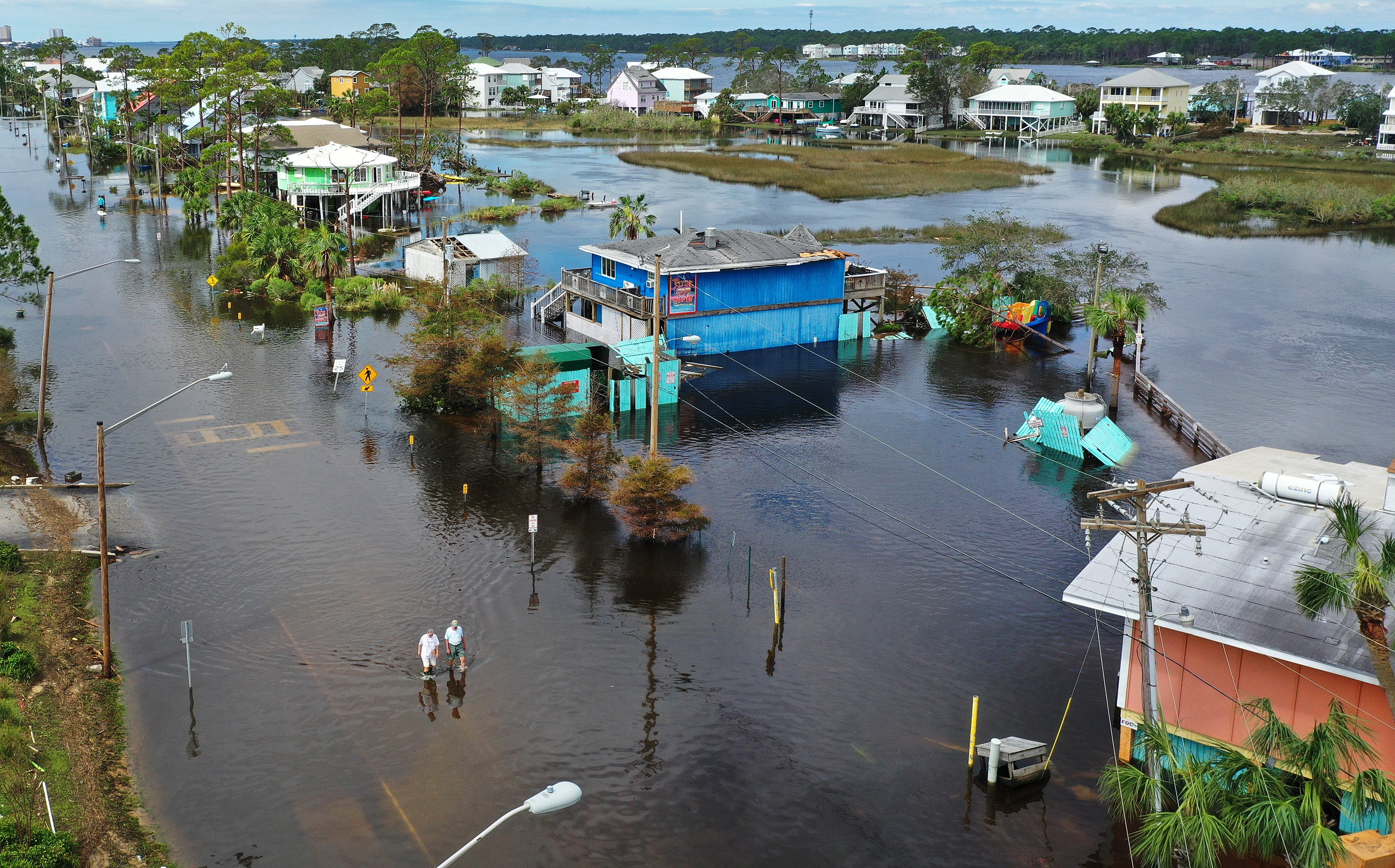
Record-warm ocean temperatures tied to climate change have supercharged Atlantic hurricanes, leading to rapid intensification of the storms.
Now, it may only take a couple of days for systems to become major hurricanes, Ken Graham, the director of NOAA’s National Weather Service, explained.
“Every Category 5 that’s made landfall in this country was a tropical storm or less three days out,” he said.
 open image in gallery
Graham urged Americans to begin to prepare for storms early and “stock up” on non-perishable food, supplies and medicine they may need now, while there is still time.
The last time there was a forecast for a below-average Atlantic season was 2015, Matthew Rosencrans, the lead hurricane season forecaster with the National Weather Service, noted.
Although every seasonal outlook comes with uncertainty.
NOAA’s forecast comes after an eerily quiet Atlantic hurricane season last year. Storms veered away from the Atlantic coast due to an area of high pressure that was farther east.
 open image in gallery
“The storms could sort of curve around the western side of the high towards Bermuda and then out into the Atlantic,” Dan DePodwin, AccuWeather’s vice president of forecasting operations, told The Independent in November.
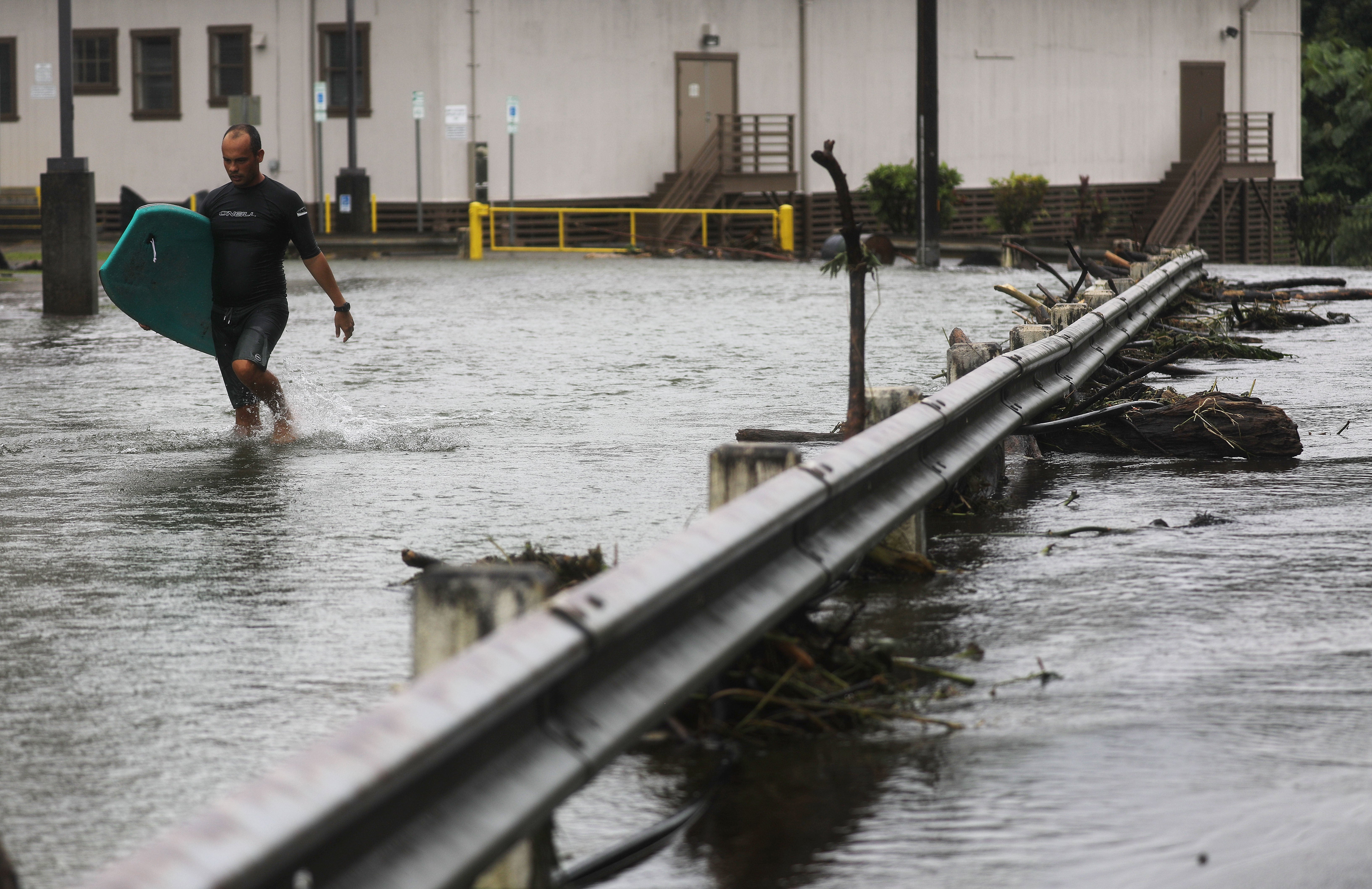
And Hawaii, which takes the brunt of eastern Pacific storms, rarely receives direct hits from hurricanes. But winds and flooding from storms have resulted in deadly and devastating impacts in recent years.
Recent flooding on Oahu was the worst in 20 years.
This is a breaking news story. Please check back for updates.