


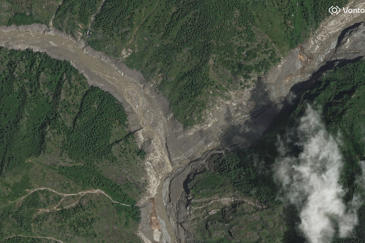
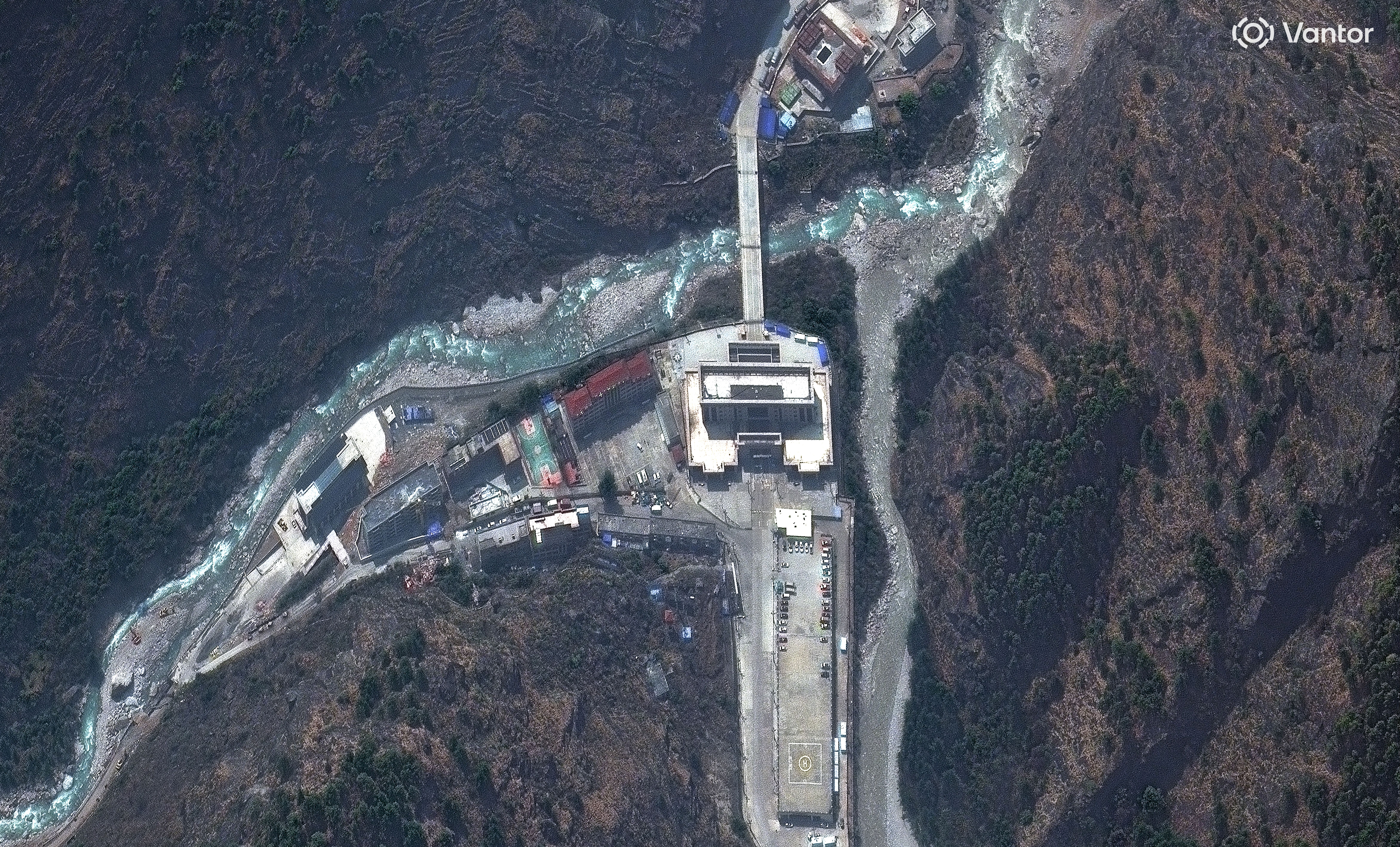
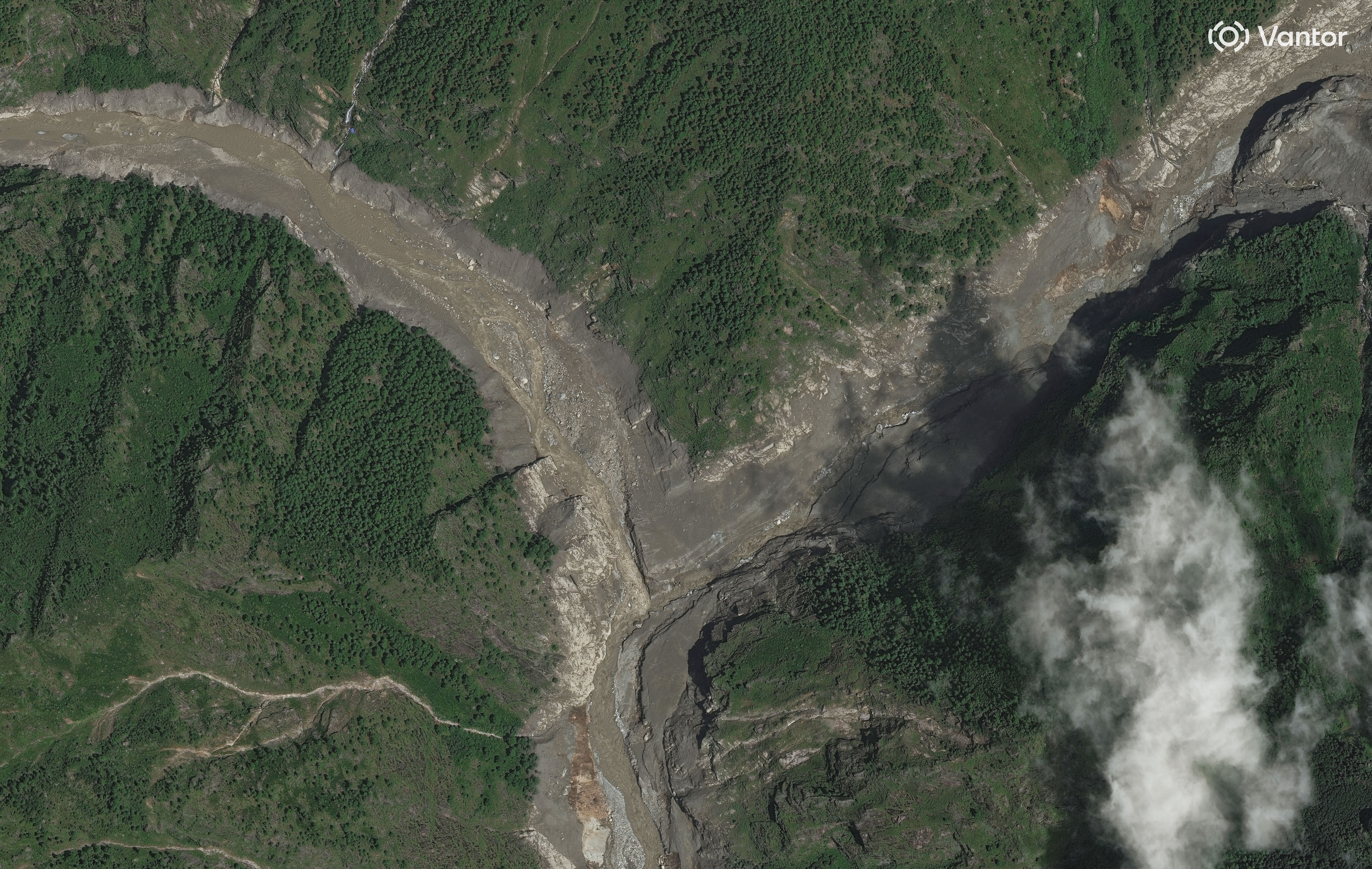
New satellite images show a key border crossing almost completely wiped out, highlighting the devastation caused by the recent flash floods along the China–Nepal border.
The before-and-after images of the Rasuwagadhi area from Vantor Holdings, Inc – an American software company specializing in spatial intelligence – show the dramatic transformation of the site.
While the first image depicts some concrete buildings, the “after” shows mud and sludge covering the entire landscape, with no visible structures standing.
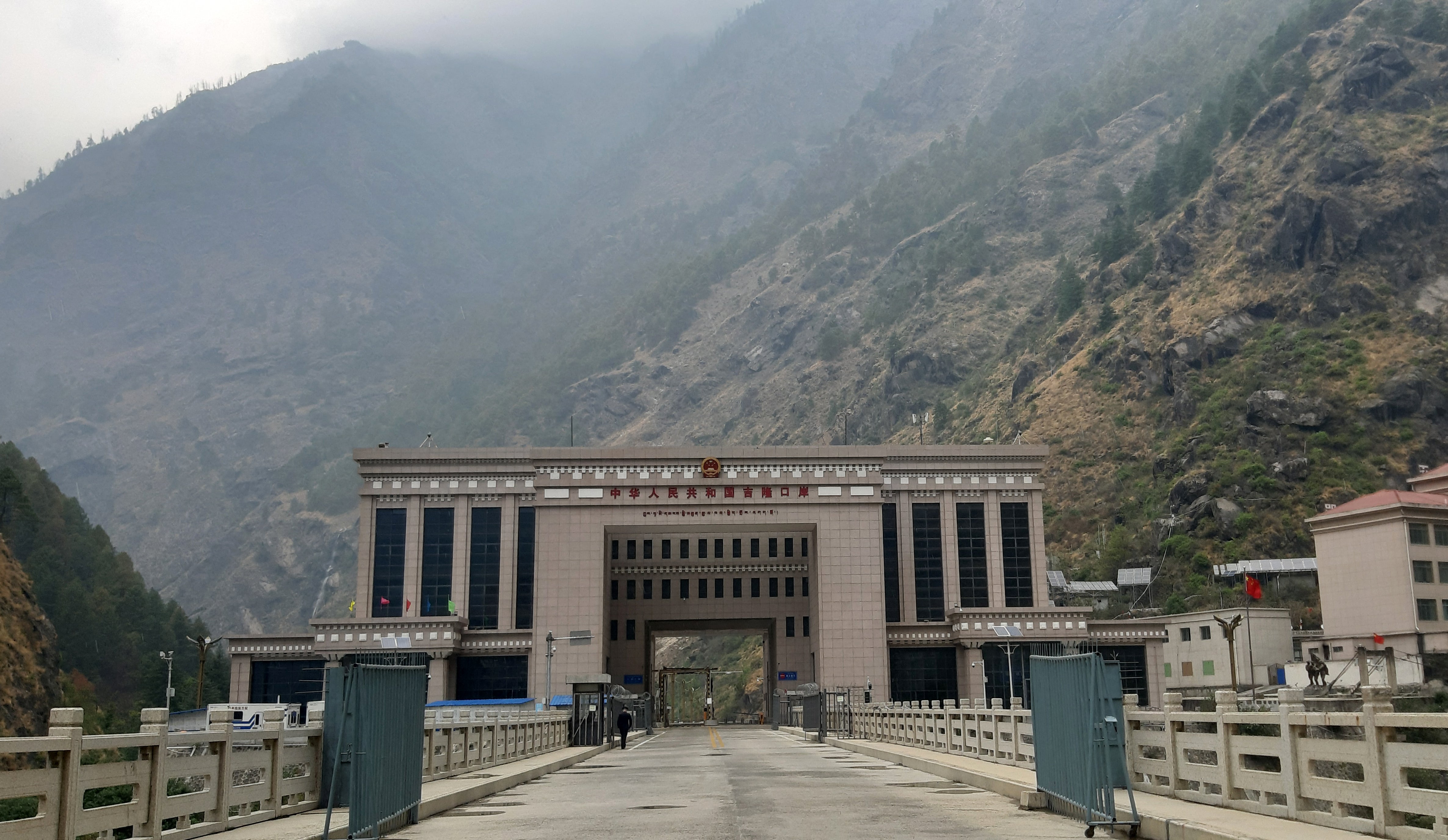
The Rasuwagadhi border crossing is an important trade and transport route between Nepal and China.
 open image in gallery
 open image in gallery
The catastrophic flash flood caused by a glacier collapse on Wednesday has killed at least 538 people in Nepal and five in China’s Tibet, with almost 1,000 more missing in the two countries.
In fact, a barrier lake formed by the landslide near the Nepal-China border has broken its banks, prompting fears of a second flash flood, officials said on Friday.
Emergency teams in China had been working to prevent the barrier lake from bursting along the flood-devastated border between its Tibet region and Nepal.
Both countries issued warnings on Thursday regarding fresh flood threats in the Himalayan range, where the barrier lake formed on opposite sides of the border risked collapsing in a region still reeling from this week’s destruction.
 open image in gallery
The destruction at Rasuwagadhi is particularly significant because the crossing sits on a major route used by traders, tourists and pilgrims travelling between Nepal and Tibet, including people heading towards the Kailash Mansarovar pilgrimage route.
China has warned that water equivalent to about 1,200 Olympic-sized swimming pools is expected to flow into the already dammed lake on its side of the border over the next three days, raising the risk of its banks bursting.
Nepali army helicopter teams are racing against time, working to rescue around 100 people trapped inside a tunnel at a hydropower project that was swamped by flooding two days earlier.